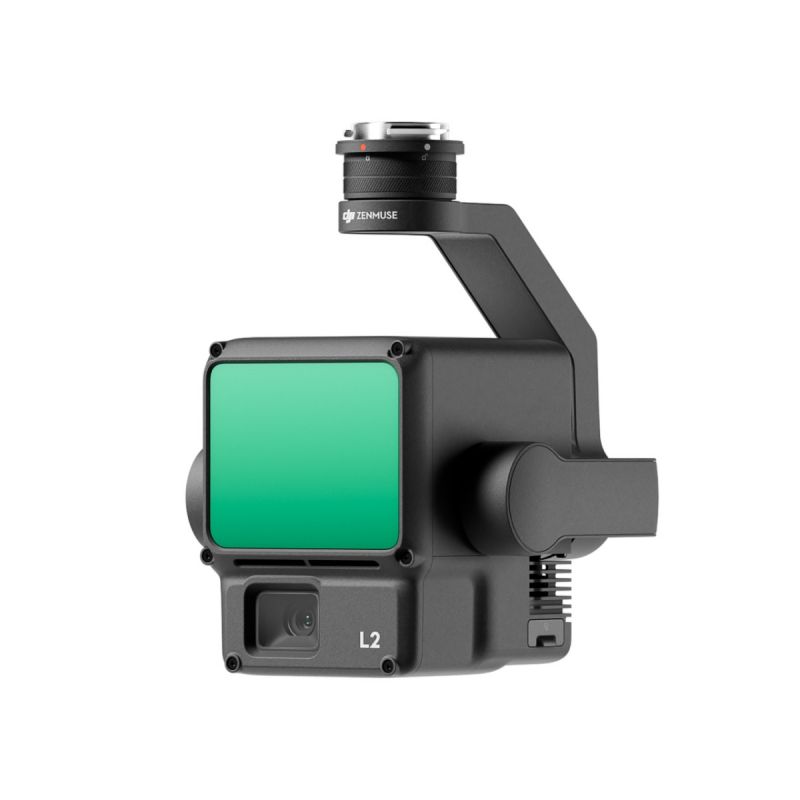
DJI Zenmuse L2 Camera
High Precision Exceptional Efficiency
Superior Penetration
250m/450m Detection Range
5 Returns Turnkey Solution
Point Cloud LiveView
One-Click Processing on DJI Terra
High Precision
By combining GNSS and a self-developed high-accuracy IMU system, this solution achieves 4cm vertical accuracy and 5cm horizontal accuracy. [1]
Exceptional Efficiency
It’s ready for work as soon as it’s powered on and can collect point cloud data from a 2.5km² area in a single flight. [2]
30% Detection Range Increase
L2 reaches a detection range of up to 250 m (10% reflectivity, 100 klx) and 450 m (50% reflectivity, 0 klx). [3] The standard operational altitude now extends up to 120 meters.
Superior Penetration
With a spot size of 4×12 cm at 100m, only a fifth of that of L1, L2 not only detects smaller objects and delivers more detailed models, but can generate DEM.
One-Click Processing on DJI Terra
Generate a standard-format 3D point cloud model with just a click, as well as a DEM. Point cloud quality can also be analyzed in DJI Terra.
Point Cloud LiveView
Supports three display modes - RGB, point cloud, and point cloud/RGB side-by-side display. Quickly preview the recorded 3D point cloud model [4] to get real-time progress monitoring.
Technical Specs
Dimensions |
155×128×176 mm (L×W×H)
|
Weight |
905±5 g
|
Power |
28 W (typical)
58 W (max.) |
IP Rating |
IP54 |
Supported Aircraft |
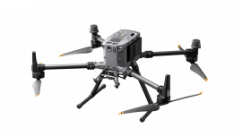
Matrice 300 RTK (requires DJI RC Plus)
Matrice 350 RTK |
Storage Temperature |
-20° to 60° C (-4° to 140° F)
|
General Operating Temperature |
-20° to 50° C (-4° to 122° F)
|
System Performance
Detection Range |
450m @50% reflectivity, 0 klx Typical data. Measured using a flat subject with a size larger than the laser beam diameter, perpendicular angle of incidence, and an atmospheric visibility of 23 km. In low-light environments, the laser beams can achieve the optimal detection range. If a laser beam hits more than one subject, the total laser transmitter power is split, and the achievable range is reduced. The maximum detection range is 500 m. |
Point Cloud Rate |
Single return: max. 240,000 pts/s
Multiple returns: max. 1,200,000 pts/s |
System Accuracy |
Horizontal: 5 cm @ 150 m Vertical: 4 cm @ 150 m |
Real-Time Point Cloud Coloring Coding |
Reflectivity, Height,
Distance, RGB
|
LiDAR
Ranging Accuracy (RMS 1σ) |
2 cm @ 150 m |
Maximum Returns Supported |
5
|
Scanning Modes |
Non-repetitive scanning pattern, Repetitive scanning pattern |
FOV |
Repetitive scanning pattern: Horizontal 70°, Vertical 3°
Non-repetitive scanning pattern: Horizontal 70°, Vertical 75° |
Minimum Detection Range |
3 m
|
Laser Beam Divergence |
Horizontal 0.2 mrad, Vertical 0.6 mrad |
Laser Wavelength |
905 nm
|
Laser Spot Size |
Horizontal 4 cm, vertical 12 cm @ 100 m (FWHM)
|
Laser Pulse Emission Frequency |
240 kHz
|
Laser Safety |
Class 1 (IEC 60825-1:2014) |
Accessible Emission Limit (AEL) |
233.59 nJ
|
Reference Aperture |
ffective Aperture: 23.85 mm (equivalent to circular)
|
Max Laser Pulse Emission Power Within 5 Nanoseconds |
46.718 W
|
Inertial Navigation System
| IMU Update Frequency | 200 Hz |
| Accelerometer Range | ±6 g |
| Angular Velocity Meter Range | ±300 dps |
| Yaw Accuracy (RMS 1σ) | Real-time: 0.2°, Post-processing: 0.05° |
| Pitch/Roll Accuracy (RMS 1σ) | Real-time: 0.05°, Post-processing: 0.025° |
| Horizontal Positioning Accuracy | RTK FIX: 1 cm + 1 ppm |
| Vertical Positioning Accuracy | RTK FIX: 1.5 cm + 1 ppm |
RGB Mapping Camera
| Sensor | 4/3 CMOS, Effective Pixels: 20 MP |
| Lens | FOV: 84° Format Equivalent: 24 mm Aperture: f/2.8-f/11 Focus Points: 1 m to ∞ (with autofocus) |
| Shutter Speed | Mechanical Shutter: 2-1/2000 s Electronic Shutter: 2-1/8000 s |
| Shutter Count | 200000 |
| Photo Size | 5280×3956 (4:3) |
| Still Photography Modes | Single shot: 20 MP Timed: 20 MP JPEG Timed Interval: 0.7/1/2/3/5/7/10/15/20/30/60 s RAW/JPEG + RAW Timed Interval: 2/3/5/7/10/15/20/30/60 s |
| Video Codec and Resolution | H.264, H.265 4K: 3840×2160 @30fps FHD: 1920×1080 @30fps |
| ISO | Video: 100-6400 Photo: 100-6400 |
| Video Bitrate | 4K: 85Mbps FHD: 30 Mbps |
| Supported File System | exFAT |
| Photo Format | JPEG/DNG (RAW) |
| Video Format | MP4 (MPEG-4 AVC/H.264 or HEVC/H.265) |
Gimbal
| Stabilization System | 3-axis (tilt, roll, pan) |
| Angular Vibration Range | 0.01° |
| Mounting | Detachable DJI SKYPORT |
| Mechanical Range | Tilt: -143° to +43° Pan: ±105° |
| Controllable Range | Tilt: -120° to +30° Pan: ±90° |
| Operation Mode | Follow/Free/Re-center |
Data Storage
| Raw Data Storage | Photo/IMU/Point cloud/GNSS/Calibration files |
| Point Cloud Data Storage | Real-time modeling data storage |
| Supported microSD Cards | microSD: Sequential writing speed 50 MB/s or above and UHS-I Speed Grade 3 rating or above; Max capacity: 256 GB. Use the recommended microSD cards. |
| Recommended microSD Cards | Lexar 1066x 64GB U3 A2 V30 microSDXC Lexar 1066x 128GB U3 A2 V30 microSDXC Kingston Canvas Go! Plus 128GB U3 A2 V30 microSDXC Lexar 1066x 256GB U3 A2 V30 microSDXC |
Post-Processing
| Supported Software | DJI Terra |
| Data Format | DJI Terra supports exporting point cloud models in the following formats: PNTS/LAS/PLY/PCD/S3MB |

